
Regional threats
Mobs, elites, bosses, breaches, resources, and world events could be generated from geography, time, state, and authored content rules.

Chapter 01
NFTerra is planned as a mobile MMORPG in which real streets, parks, waterfronts, districts, and verified venues provide the geography for a separate dark-fantasy game layer.
Map below. Game above.
The proposed client would use Google Maps SDK for geographic context and render NFTerra's original characters, enemies, resources, structures, effects, and interface as a separate game layer.
A phone-reported coordinate would be treated as untrusted evidence. The backend would decide movement validity, encounter eligibility, rewards, and cooldowns.
A map of the intended game context
This conceptual map separates the readable real-world foundation from server-controlled game opportunities. It is an explanatory diagram—not a proposed GPS interface.

From location signal to persistent reward
Generated content would pass through safety, eligibility, regional, timing, and economy rules before a player could see or resolve it.
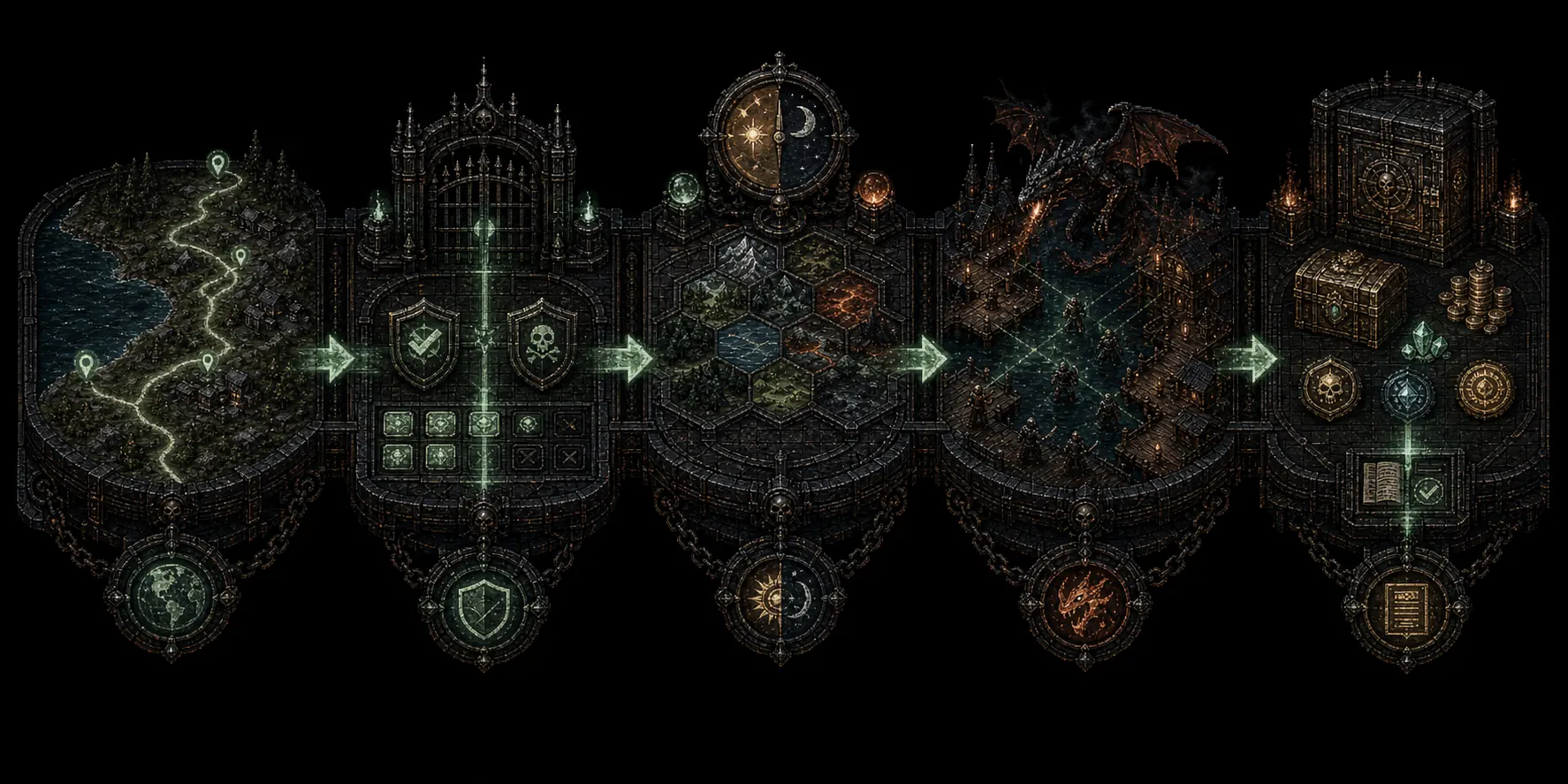
A possible play session
A short walk could begin an encounter, but the wider game would connect that moment to skills, crafting, markets, clans, and persistent item histories.
The client would request safe, eligible content for the player's validated game area.
The player could move toward a resource, breach, boss, event, service, or contested boundary.
The server would resolve combat, gathering, cooperation, or another approved interaction.
Rewards could include materials, currency, quest rewards, or sealed unidentified bases.
The player could use, hold, trade, craft with, or eventually mint the recovered value.
Persistent MMORPG systems
NFTerra's planned depth comes from systems that continue beyond the moment of movement.
Mobs, elites, bosses, breaches, resources, and world events could be generated from geography, time, state, and authored content rules.
Combat, gathering, production, construction, and utility skills are planned to progress through use, creating distinct professions.
Specialists, traders, clans, service providers, explorers, and fighters would depend on one another rather than share one optimal path.
Created relics, trade history, clan history, settlement structures, territory upkeep, and specialist reputation could survive beyond one session.
These mechanics are not yet confirmed, but they reveal important product intent that was missing from the public explanation.
Terrain, country, city history, landmarks, and authored local context could influence enemies, appearances, loot, and events without stereotyping real cultures.
Local time and day/night state could change available creatures, bosses, gathering conditions, hazards, and encounter rules.
A nearby breach—such as a dragon attacking docks—could notify eligible players within a safe, capacity-limited radius.
Nearby players could trade, communicate, cooperate, negotiate, flee, pursue, sabotage, or betray under explicit visibility and consent rules.
PvP could be enabled only in designated states or zones, with safe areas and protected services remaining non-combat spaces.
Experience and party rewards could recognize meaningful participation while limiting effortless carrying by much stronger players.
Safety before reward
A geolocation MMORPG needs stricter rules than an ordinary map interface.
The intended design would exclude dangerous, private, restricted, inaccessible, or inappropriate destinations; discourage interaction while driving; respect closure and capacity; provide emergency controls; and avoid exposing another player's exact location.
Speed, timing, route plausibility, device integrity, and replay signals would inform eligibility.
Precise and historical coordinates would be limited, retained deliberately, and kept out of public records.
Content rules would consider operating hours, accessibility, crowd risk, boundaries, and incident response.
Next chapter
Review the planned character identities, starter loadouts, independent disciplines, specialist professions, and boundaries around purchased progression.